Old, and Some New, Photographs of Woodbridge & Melton
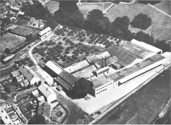
This photograph shows the final expansion of the Woodbridge Canning Company in the 1960s.
By 1950 the town planers were considering measures to ease the flow of traffic through the narrow streets of the Town. A key element in their proposed solution was the construction of a new street which ran parallel to the Thoroughfare and bisected both Quay Street and Brook Street.
In 1967 the route was changed to make more use of existing roads - the road was to run along Station Road and Quayside then up what is now Hamlin Road and along the top of Elmhurst Park.
Fortunately when the road was finally built in 1976 it went along the bottom of Elmhurst gardens rather than the top of it. Only 0.31 acres of the 4.4 acre gardens was lost to the road. About the same time as the road was built the one remaining gas holder was demolished and shortly after the canning factory moved to Martlesham Heath.
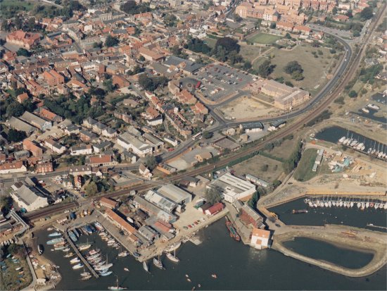
The closure of the canning factory released a significant most of land which made it possible to transform the area between Brook Street and Elmhurst Park.
Phot035 Previous photograph in this series