Old, and Some New, Photographs of Woodbridge & Melton
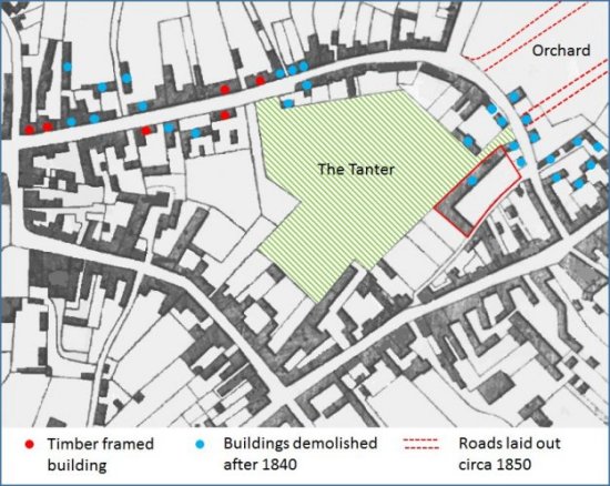
A simplified version of the 1840 tithe map is shown below. The blue dots mark buildings which were demolished post 1840. The red dots mark the 6 buildings which were found to be wholly or partially timber framed when a survey was conducted in 2004. The green crosshatched area was the garden of Alexander’s bank (now Barclays) on Church Street. Most of the garden was called The Tanter.
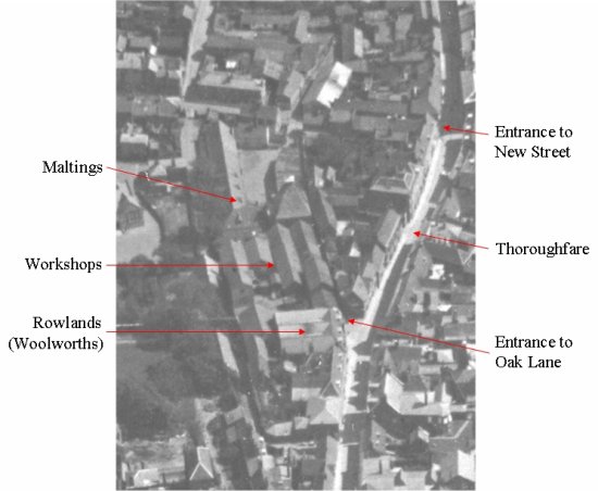
The building outlined in red, which abutted The Tanter, the garden was a maltings. This three storey brick building was sold by John Cobbold in 1876.
In the 1950s and 60s the building was used as plumber’s store and a coach builder’s workshop. It was then taken over by the builder Ingram Smith who moved out in 1971 and sold the property to the Urban District Council. The Council demolished the maltings and used the site for the Oak Lane car park which opened in 1975. Some cottages just above the entrance to the new car park were removed and replaced by two dwellings with another four behind in Oak Court.
The Country School was built in 1909, on what had been The Tanter, to replace the British and Foreign School on Castle Street.
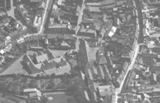
The school was within the arrow shaped area which is on the left of the aerial photograph taken circa 1935. There were two entrance to the school grounds. Between the entrances there was terrace of buildings abutting New Street.
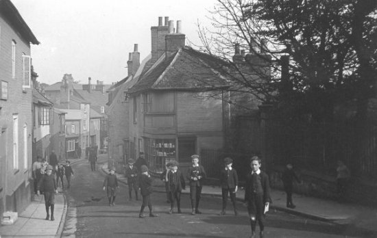
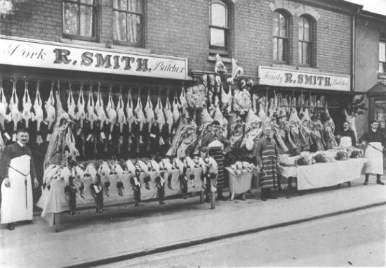
This photograph shows a sweet shop which was a mecca for the children attending the Primary School. The shop abutted the eastern entrance to the school.
The 1971 Town Plan envisaged a Market Hill bypass running down the Naverne valley to a car park on the site of the Country Primary School, which was to be moved to Melton. The threat of these changes, and a proposal to widen New Street, blighted the line of 18th century cottages adjacent to northern edge of The Tanter and many fell into a semi-derelict condition. When the road widening proposal was dropped in 1975 the District Council decided to restore the cottages. The only building to be demolished was a house, which at one time been a sweet shop, at end of the terrace. The vacated site was used for a private parking area and a small courtyard.
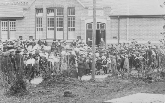
This photograph shows the opening ceremony of the Woodbridge County School.
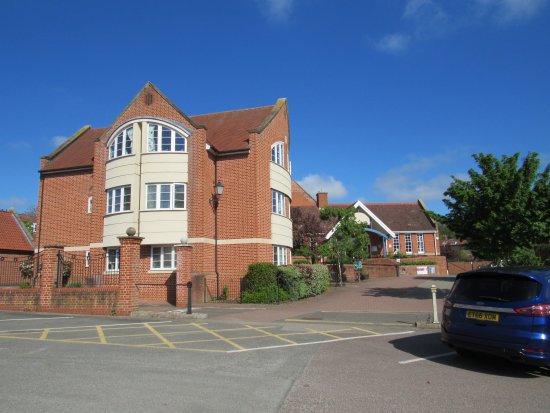
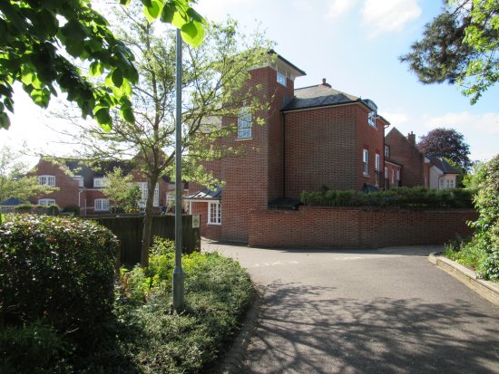
In 2001 Suffolk County Council and Greystoke and Everleigh Ltd. unveiled a scheme to relocate Woodbridge Primary School and Woodbridge Library. The school would be moved a site at the bottom of Pytches Road and a new library would be created in part of the old school. The new school and library would be funded by the developers who, in return, would have the remaining land on which to build 23 houses and a medical/health facilities for the surgery in Little St John's Street.
Opposition to the proposal came from Woodbridge residents who were mainly concern about (i) the loss trade because parents would no longer use the local shops when delivering or collecting their children and (ii) the visual impact of the new residential build on the surrounding area. Opposition from Melton residents were, in the main, based on the belief that the sale of some of the designated plot for residential development had reduced the viability of the site for a school and on concerns about (i) the impact of traffic delivering and collecting children from school and (ii) the lack of adequate footpaths along Pytches Road. Supporters accepted that (i) it was not economically viable to bring the old school up to modern standards, that (ii) the majority of pupils attending the school were from Bury Hill area, and (iii) that pedestrian access from that area to the old school was inadequate. After several public consultations a formal planning application was submitted in January 2004 and was approved in July of that year.
This aerial photograph taken circa 1935 shows the extensive building between Oak Lane and the grounds of the Woodbridge County School. To the north of Rowland's Department Store (later F W Woolworth) there was a extensive range of workshops associated with the store. Most of the latter were demolished in in the 1940s to create Oak Lane Car Park. Access to the car park was via the Thoroughfare. Ownership of the land was land was retained by F W Woolworth and this was later to effect the future development of the car park.
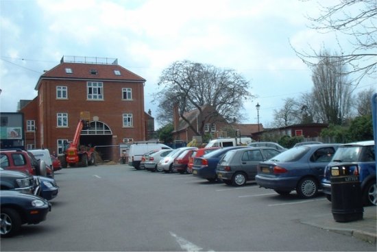
By 1989 all the buildings associated with the maltings had been demolished and the Oak Lane Car Park had been expanded significantly. The was access to the car park from both New Street and the Thoroughfare.
In 2005 F W Woolworth exercised their right to build on that part of the Oak Lane Car Park which belonged to them. Soon after they were granted planning permission to erect a three-story building with basement car park, to provide three retail units and 14 one-bed residential units.